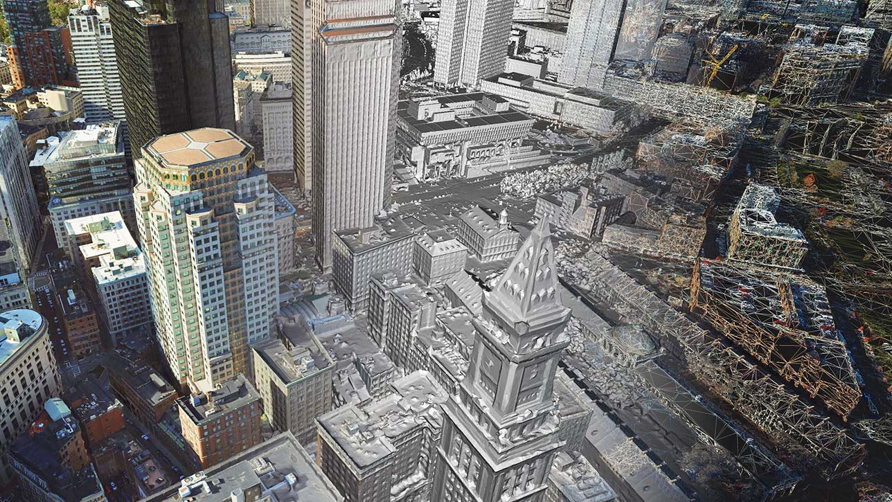
ArcGIS Reality Studio is an advanced photogrammetry product optimised for precision, speed, and simplicity. Use this scalable solution for city and countrywide aerial mapping to create the foundation of 3D digital twins. Align large collections of images captured by multicamera sensors across multiple flights to create highly accurate true orthos, 3D meshes, and point clouds. An intuitive map-centric 3D interface provides automated processing workflows for the efficient creation of survey-grade products. Easily collaborate and share data within geographic information system (GIS) technology and mapping systems for photo-realistic visualisation and analysis.
Create accurate real-world depictions

Shorten time to delivery
Automated and efficient workflows reduce the time it takes to process aerial imagery to create 3D outputs.

Scale your work
Automate the production of geometrically accurate true orthos and photo-realistic textured 3D meshes.

Gain a competitive edge
Best-in-class image alignment to produce true orthos and 3D meshes, with outputs optimised for efficient web streaming.

Minimal training required
Designed with an intuitive user experience and a mapcentric 3D interface, ArcGIS Reality Studio lets you reference your data all in one place. Get started quickly with automated processing workflows to determine the ideal parameters for all processing steps.

Easily deliver products
Outputs created with ArcGIS Reality Studio can immediately be used within the ArcGIS system or third-party mapping systems. Your customers can perform advanced analysis like machine learning or object detection within ArcGIS.

Proven algorithms
The combined expertise of Esri and nFrames, a leading provider of 3D image reconstruction software and services, has created the most advanced aerial reality mapping solution. Esri provides extensive research and development to continually improve and grow the capabilities of your production tools.
Ready to learn more? Contact us to speak to a product specialist.
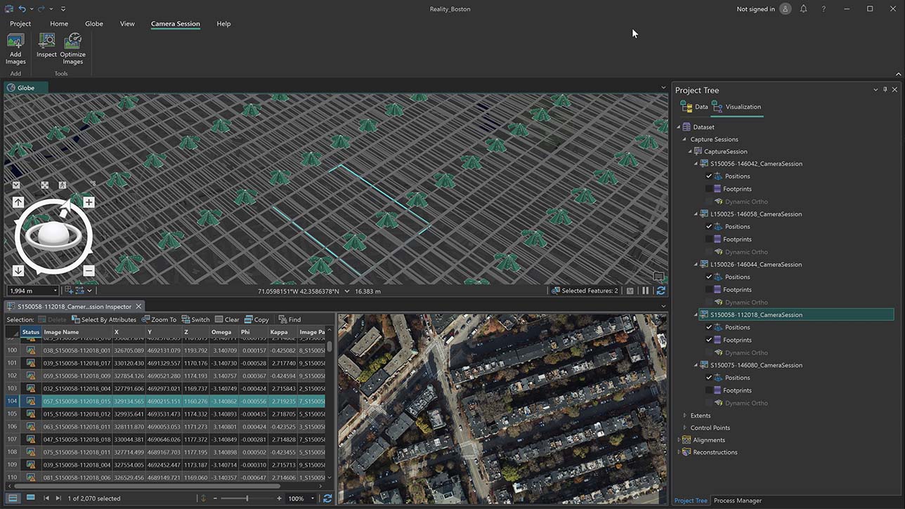
How it works
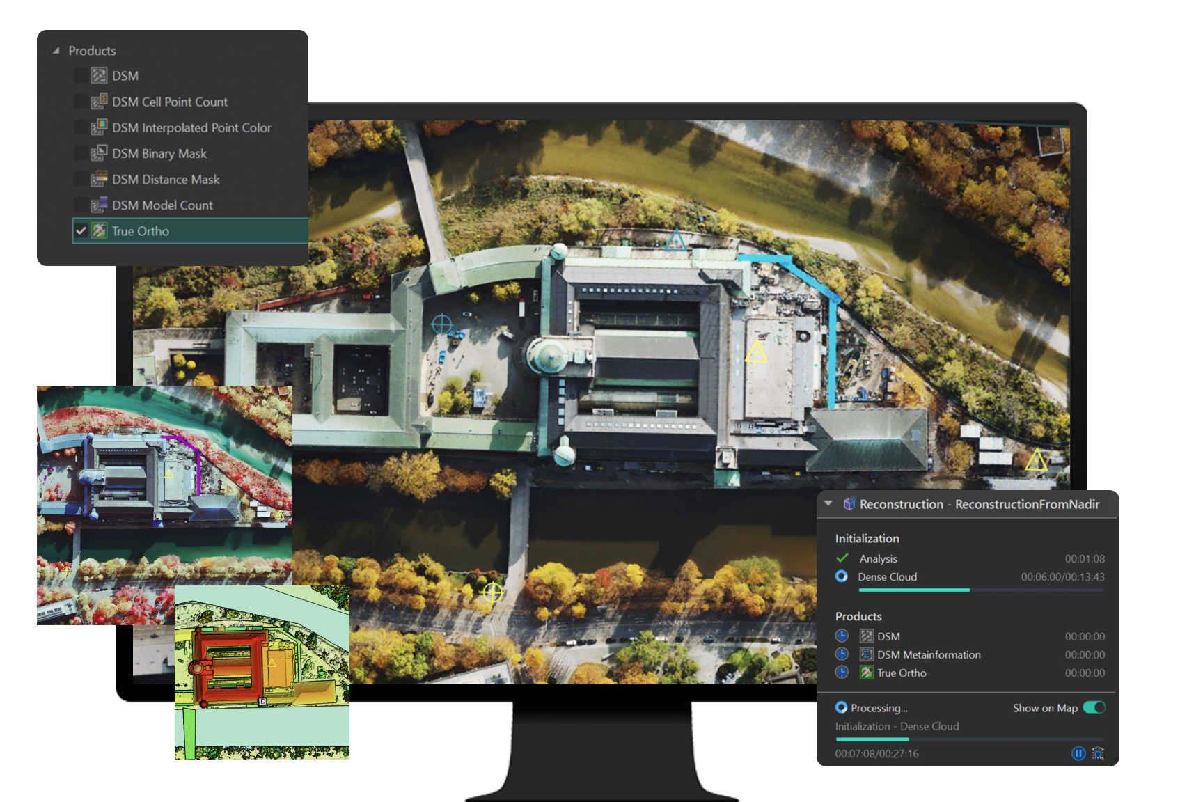
Load and manage data from multiple flights and multicamera systems. Use control points and reuse existing measurements. Import polygons to constrain surfaces or to set a region of interest.
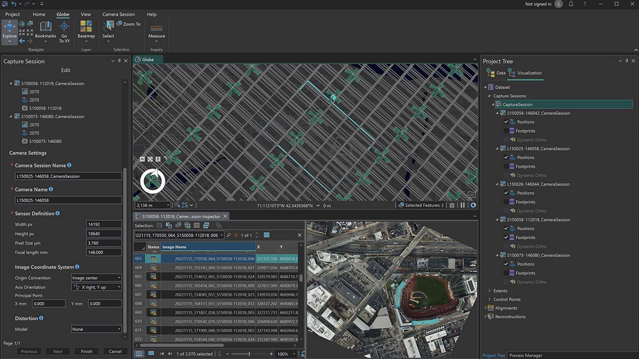
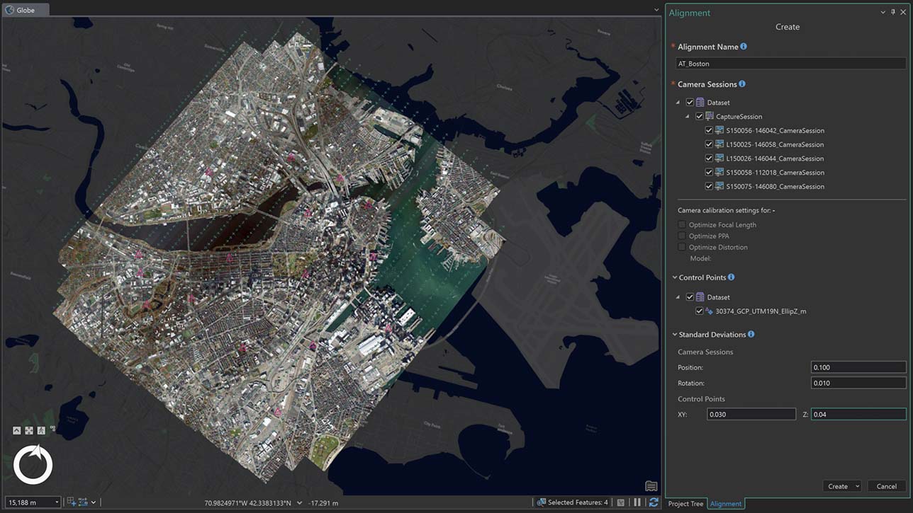
Optimise the relative and absolute orientation of imagery from multiple flights. Measure control points to correctly georeference your results. Reestimate camera parameters if necessary.
Turn large collections of aligned images into high-quality 3D meshes, point clouds, digital surface models, and true orthos. Control the resolution of the output rasters and meshes. Track progress on the map.
Iterate on the alignment and reconstruction to deal with problematic datasets. Use statistical insights to fine-tune out-of-the-box results and manage challenging data.
Use the web to efficiently share available results with your organisation and clients. Results are provided in open standard formats and are ready for web streaming.
ArcGIS Reality Product Suite
Explore the software applications that are a part of ArcGIS Reality. Find the reality mapping software that fits the size of your projects and the sensors you work with.

ArcGIS Reality for ArcGIS Pro
Use this extension to generate large-scale true orthos and 3D meshes from drone and aerial sensors in ArcGIS Pro.

Site Scan for ArcGIS
Process large volumes of drone imagery faster with cloud-based data processing and create 2D and 3D maps and models that you can quickly share across your organisation.
ArcGIS Drone2Map
Process drone imagery while offline or in the field. Turn recently collected drone images into 2D and 3D models, even without an internet connection.
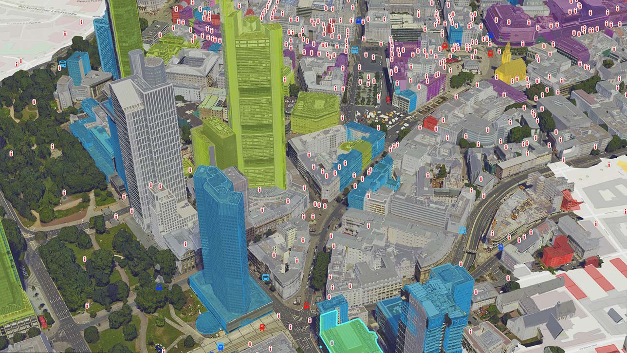
ArcGIS Reality and digital twins
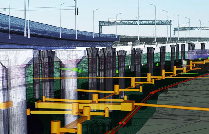
Digital twins are representations of real-world objects and their processes and relationships. With ArcGIS Reality, users create highly accurate 3D meshes, true orthos, and point clouds to use as an important piece when developing 3D digital twins of social, natural, and built environments. Learn more about Esri’s 3D capabilities and how they relate to a comprehensive digital twin.