To find out more about the Esri and Autodesk partnership call a product specialist on +60 (3) 5022 0122 or complete this form and a member of our team will get in touch.
It's all about context
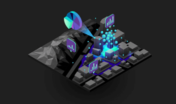
Think about roads, bridges, waste management plants, gas lines, and so on, not just in context of one another and the topology of their natural environment, but in the context of larger environmental factors—air quality, wind resource potential, solar potential, storm impact, flood behavior, fire behavior, aircraft noise, soil quality, and so on.
Data at the center
Esri and Autodesk are working to bring together GIS and BIM (building information modeling) across multi-disciplinary teams and project life cycles. The vision is that of an integrated and collaborative workflow that advances understanding of projects in context, and reduces inefficiencies, data loss, and cycle times.
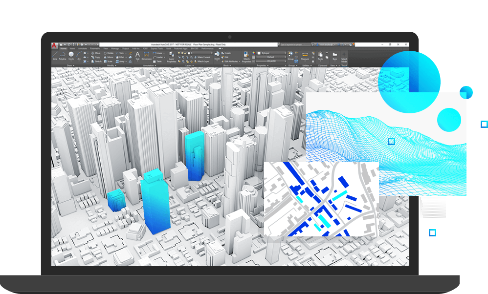
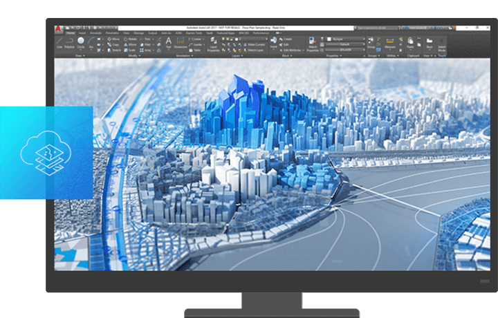
InfraWorks connects to Esri's ArcGIS Online
Designers and engineers can now bring GIS content from ArcGIS Online into InfraWorks through the Autodesk Connector for ArcGIS. Content such as roads, pipelines, and electrical transformers can now be directly imported based on an authoritative, current geographic system of record.
Resources

FAQs
- What is the Esri and Autodesk alliance about?
Announced on November 15, 2017, the alliance between Esri and Autodesk helps to connect "Make Anything" with "The Science of Where" through more tightly integrated BIM and GIS workflows, enhancing how infrastructure assets are planned, designed, built, and operated. Together with Esri, this alliance enables Autodesk to better deliver on the promise of helping customers imagine, design and create a better world.
Autodesk and Esri are committed to the development of more seamless exchange of spatial and attribute data typically captured in Esri's GIS systems and the information from 3D BIM models in Autodesk's design software.
- Who will benefit from this alliance?
The alliance of Esri and Autodesk is aimed at improving efficiency and collaboration for owner/operators, such as city and regional government planners and executives, and AEC firms who plan, design, and carry out capital projects for the owner/operators.
- What is BIM?
BIM (Building Information Modeling) is an intelligent 3D model-based process that gives architecture, engineering, and construction (AEC) professionals the insight and tools to more efficiently plan, design, construct, and manage buildings and infrastructure.
Technology is transforming the way that buildings and infrastructure are designed, constructed, and operated. And it's helping to improve decision making and performance across the building and infrastructure lifecycle.
- What is GIS?
A geographic information system (GIS) is a system designed to capture, store, manipulate, analyse, manage, and present all types of geographical data. This data is typically associated with spatial characteristics; i.e., having some reference to specific location information.
In GIS, geospatial location data is usually coupled with attribute data – this provides users with information about "where" as well as "what" for a given geographical area. The combination of these data types makes GIS a highly effective planning and problem-solving tool, allowing users to use location as a key index in interactive queries to better understand relationships, patterns, and trends between places and things.
- Why connect GIS and BIM?
With the integration of GIS and BIM at the center of infrastructure projects – houses, schools, roads, inter-modal transit facilities, drainage and energy networks, etc. – are no longer planned, designed and built in isolation of everything around it. Infrastructure assets can be better viewed in relation to how that asset fits and interacts with the surrounding ecosystem. More tightly connected GIS and BIM workflows aid stakeholders involved in planning and design to better understand how the natural and existing built environment connects with the new assets to be built.
The promise of more tightly integrating GIS and BIM is to empower AEC firms and project owners to focus not only on what to design and build, but also better understand where and why, helping them to deliver more sustainable and resilient infrastructure through more economical, social, and environmentally responsible practices.
- Where can I find more information?
For more information about the Esri and Autodesk partnership call a product specialist on +60 (3) 5022 0122 or complete this form and a member of our team will get in touch.