You are here News and events News News Search news Search by year All2024202320222021202020192018201720162015201420132012 Tags - Any -3DABSAECAgileAgribusinessAgricultureAnalyticsAppsAppStudioArcGISArcGIS 10.5ArcGIS 10.6ArcGIS EnterpriseArcGIS HubArcGIS IndoorsArcGIS MonitorArcGIS OnlineArcGIS ProArtificial intelligenceAsset managementAugmented realityAustralian Bureau of StatisticsAutodeskBankingBIBig DataBig Data AnalyticsBIMBorder PatrolBusinessBusiness IntelligenceCadastreCalifornia CoastlineCitizen engagementCloudCloud computingCloud GISCollectorCommercialCommercial propertyCommunityContentCoronavirusCouncilCOVID-19CrisisCrowdsourcingDataData analyticsData visualisationDeep learningDefence and intelligenceDekhoDesignDigital transformationDisruptive appsDronesE-governmentE-IdamanEducationEISBeLearningElectionElectorateElectricElectricityEmergency managementEmergency responseEmergency servicesEMUC 2018 - AdoptEMUC 2018 - Afternoon plenaryEMUC 2018 - DeepenEMUC 2018 - ExtendEMUC 2018 - PlenaryEMUC 2019 - ExtendEnergyEnergy, oil, gas and renewablesEngineeringEnterprise GISENVIEnvironmental managementEsriEsri AustraliaEsri Petroleum ConferenceEsri UCEsri Young Scholars AwardEventsFederal governmentFinancial institutionsFinancial servicesFood securityForestryForresterGasGDA2020GDA94Geo hubGeoAIGeoAnalyticsGeographic datumGeographic Information SystemsGeoInnovation AwardGeoInnovation AwardsGeospatial AnalyticsGISGIS for schoolsGIS in land administrationGIS in Telecommunications - featureGIS managerGIS server softwareGIS technologyGIS web servicesGovernmentHealthHealth and human servicesHomeland SecurityIcon WaterIDLImageryImpact AwardsIndoor navigationInnovationInsights for ArcGISInsuranceInsurance and BankingInteractive mapsInternet of ThingsInternshipInteroperabilityIoTJack DangermondJavaScriptKerajaan Negeri SembilanLand AdministrationLand managementLaura DangermondLaw enforcementLive dataLive sensorsLocal governmentLocation intelligenceLocation-based analyticsLogisticsMachine learningMappingMapping and chartingMapsMaritimeMediaMicrosoft AzureMiningMobileMobile applicationsMobile GISMount AgungMRT CorpNational developmentNational SecurityNot for profitOH&SOilOpen dataOpen platformOperational awarenessOz MineralsOzriPartnershipPetroleumPETRONASPlanningPortsPredictive analysisProductsPublic safetyPublic sectorQueensland GlobeRaster dataReal-time analyticsRemote sensingResilient communitiesResourcesRetailROISaaSSabah Lands and Surveys DepartmentSafe communitiesSAG AwardsSAPSAR ImagerySARscapeSatellite imagerySensorsSmart citiesSmart communitiesSmart transportSmarterWXSoil healthSolar eclipseSpatial data infrastructure solutionsSpeculative designStartupsState governmentStory mapsSupply chain managementSurvey123Sustainable developmentTelcoTelecommunicationsTrainingTransformationTransportTransport analyticsTransport and InfrastructureTransportationUIUnearthed ChallengeUnited NationsUnmanned Aerial VehiclesUrban analyticsUrban planningUser experienceUser interfaceUser researchUtilitiesUtility networkUXUXGVirtual realityWaterWaterfallWeb GISWHOWorking lands PETRONAS, SLSD and Negeri Sembilan receive SAG Award PETRONAS, Sabah Lands and Surveys Department and Negeri Sembilan were selected to receive the 2018 Special Achievement in GIS Award. Learn more PHM saves million with enterprise GIS Pertamina Hulu Mahakam has been recognised as a global best-practice for its implementation of an enterprise spatial analytic platform that has saved millions of dollars annually. Learn more GIS technology empowers disaster mitigation Leading Indonesian disaster management experts discuss how advanced GIS technology can safeguard the country from earthquakes, tsunamis, landslides, volcanic eruptions, flooding and droughts. Learn more News Esri supports SAP HANA platform A global announcement by SAP and Esri enhances performance and scalability by integrating enterprise and geospatial data into core business processes. Learn more News Study: 93 per cent find GIS key to a smart nation A landmark report reveals that 9 out of 10 professionals working in Malaysia's local government sector believe GIS is key to achieving a smart nation status. Learn more News Petronas, DBKK, DBKL receives prestigious GeoInnovation Award DBKK, DBKL, Petronas Carigali (PCSB) and a number of other organisations have been selected to receive an award for their use of geospatial technologies to support Malaysia's TN50 vision. Learn more News 3D smart maps aid response efforts in Bali A smart mapping portal visualises volcanic activity in Bali to provide valuable information to emergency responders and the public. Learn more News IRDA partners with Esri Malaysia on Urban Observatory Iskandar Regional Development Authority and Esri Malaysia have signed a memorandum of understanding in a bid to set the momentum for Digital Economy in Iskandar Malaysia. Learn more Penang GIS receives SAG Award for e-Peta Learn more Gartner names Esri among leading geospatial platform vendors Learn more Bank Muamalat drives growth with advanced location-based analytics Learn more Esri-Waze partnership delivers open-data sharing options to governments Learn more GIS powers up utilities sector Learn more Esri earns top rank in Forrester report Learn more Geospatial technology to make RMK11 programs more targeted Learn more Learn what its like to be an Esri Young Scholar Learn more MaCGDI wins global tech award Learn more Smart mapping app improves community services in Penang Learn more Industry leaders turn to GIS to maximise value Learn more JUPEM earns global recognition for latest geospatial project Learn more Load More
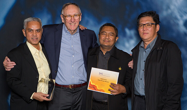
PETRONAS, SLSD and Negeri Sembilan receive SAG Award PETRONAS, Sabah Lands and Surveys Department and Negeri Sembilan were selected to receive the 2018 Special Achievement in GIS Award. Learn more
PHM saves million with enterprise GIS Pertamina Hulu Mahakam has been recognised as a global best-practice for its implementation of an enterprise spatial analytic platform that has saved millions of dollars annually. Learn more
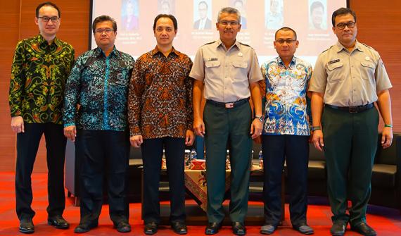
GIS technology empowers disaster mitigation Leading Indonesian disaster management experts discuss how advanced GIS technology can safeguard the country from earthquakes, tsunamis, landslides, volcanic eruptions, flooding and droughts. Learn more
News Esri supports SAP HANA platform A global announcement by SAP and Esri enhances performance and scalability by integrating enterprise and geospatial data into core business processes. Learn more
News Study: 93 per cent find GIS key to a smart nation A landmark report reveals that 9 out of 10 professionals working in Malaysia's local government sector believe GIS is key to achieving a smart nation status. Learn more
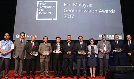
News Petronas, DBKK, DBKL receives prestigious GeoInnovation Award DBKK, DBKL, Petronas Carigali (PCSB) and a number of other organisations have been selected to receive an award for their use of geospatial technologies to support Malaysia's TN50 vision. Learn more
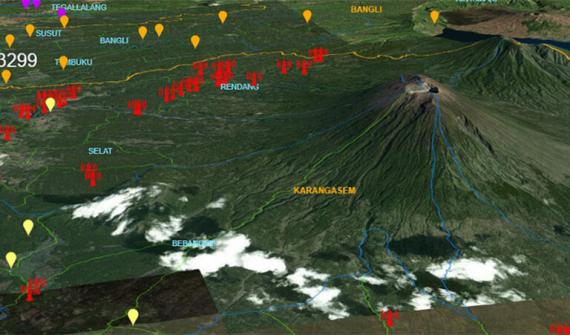
News 3D smart maps aid response efforts in Bali A smart mapping portal visualises volcanic activity in Bali to provide valuable information to emergency responders and the public. Learn more
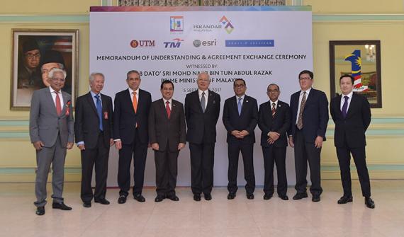
News IRDA partners with Esri Malaysia on Urban Observatory Iskandar Regional Development Authority and Esri Malaysia have signed a memorandum of understanding in a bid to set the momentum for Digital Economy in Iskandar Malaysia. Learn more