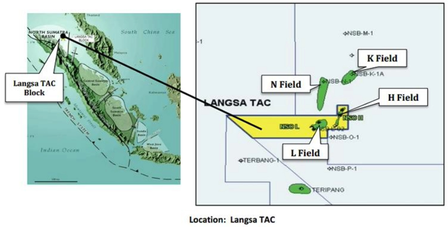
In 2017, a storm damaged Pertamina’s subsea Langsa Floating Production Storage and Offloading (FPSO) facility in the Strait of Malacca — approximately 100 kilometers east of Aceh, Indonesia — temporarily halting operations.
The restoration program that ensued revealed the lack of validated barriers and limited well data, both of which posed significant challenges to resuming operations safely.

With a primary focus on securing the Langsa wells and devising new strategies for data acquisition, response teams recruited geomatics and GIS experience from across the organisation to build a foundation for data integration, analysis, and visualisation.
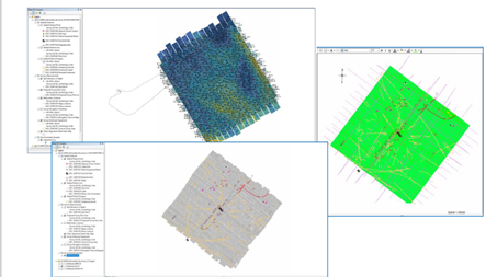
Remotely Operated Vehicles (ROV) were deployed to collect accurate bathymetric data, managed in a Seabed Survey Data Model (SSDM) to measure the extent of the damage.
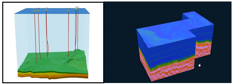
By incorporating the data into subsurface geology modeling, a comprehensive and accurate representation of the seabed profiles, including subsea environments as well as subsurface geology.

3D data visualisation and contextualising the subsurface environment delivered a holistic view of the complex geospatial landscape to senior executives, enabling informed, data-driven decision making that would help restart production in the Langsa Field.

Image 4. 3D seismic visualization of Langsa Field as Voxel Layer within ArcGIS.
“In a first for South-East Asia, Pertamina pioneered the curation of a comprehensive 3D subsea representation using 3D subsea stereo photogrammetry.” Said Puguh Sarwanto, Pertamina Lead Specialist - Innovation Geomatic.
Leveraging geomatics expertise
The successful implementation of this project heavily relies on leveraging the full spectrum of geomatics expertise.
From geodesy and survey operations to geospatial data management, visualisation, and analysis, each skillset plays a critical role.
The integration of these disciplines ensures rapid and integrated access to trusted data and information, offering valuable insights to both technical experts and management teams.
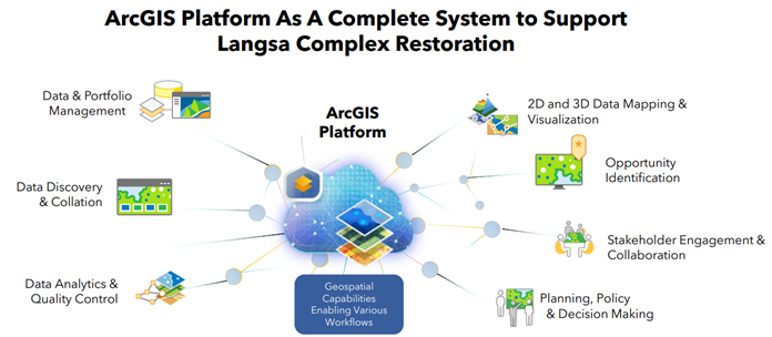
In conjunction with this expertise, the project strategically utilises ArcGIS as a comprehensive system, serving as the backbone for supporting the Langsa complex restoration.
This platform facilitates efficient data management, powerful visualisation, and in-depth analysis, contributing significantly to the seamless integration of geomatics aspects and enhancing decision-making capabilities throughout the project lifecycle.

Safety and environment
For Langsa complex, the convergence of seismic data, vertical datum understanding, and meticulous survey planning stands as the foundation for a successful restoration.
Addressing safety and environment concerns remains paramount, with personnel monitoring, infrastructure and environment playing a pivotal role in ensuring safe operations.
This journey has been a multilayered orchestration, and it will inform appropriate recommendations on the re-commissioning process.
Conclusion
Underpinned by GIS-led insights and geomatics expertise, the Langsa restoration program set a new regional standard for addressing immediate challenges imposed by critical incidents. While it contributes to resuming production, the insights it has provided will inform future strategies and industry practices for subsea restoration and exploration.
Connect with us to tailor solutions for your specific needs throughout the oil and gas lifecycle.
