You are here News and events Esri Malaysia blog Esri Malaysia blog From insight to action: What we learnt at Esri UC 2026 Explore five key lessons from Esri UC 2026 – from AI and operational intelligence to digital twins, trusted adoption and practical ArcGIS improvements. Learn more From ambition to action: Sustainability insights from Esri UC 2026 Explore five sustainability insights from Esri UC 2026, from observing environmental change and strengthening resilience to using living digital twins and trusted AI. Learn more AI in GIS: 5 takeaways from Esri UC 2026 Here are five takeaways from Esri UC 2026 for organisations exploring AI in GIS. Learn more How TNB improved land management and field visibility across Malaysia At Tenaga Nasional Berhad (TNB), the Land Management Unit (LMU) is transforming how land health assessments are conducted across Malaysia by improving inspection coordination, streamlining field workflows, and enhancing operational visibility across critical utility infrastructure and land assets. Learn more Low-carbon city planning with GIS: Practical steps for local authorities Discover how local authorities can use GIS to enable low-carbon city planning. Learn practical steps to model scenarios, reduce emissions, and make data-driven planning decisions. Learn more ArcGIS Enterprise 11.5: Prepare for version 12 Stay ahead by learning what’s new in ArcGIS Enterprise 11.5 and prepare your upgrade with ease. Learn more How remote sensing is transforming decision making Discover how satellites, drones, and AI are helping organizations make smarter, faster decisions across agriculture, mining, urban planning, and disaster response. Learn more How organisations can benefit from remote sensing and AI From precision agriculture and sustainable mining to smarter cities and faster disaster response, remote sensing and AI provide accurate, real-time insights that help organisations boost efficiency, enhance safety, and make informed, data-driven decisions. Learn more Enhancing Langsa restoration with location insights With a primary focus on securing the Langsa wells and devising new strategies for data acquisition, using GIS technology, Pertamina to build a foundation for data integration, analysis, and visualisation. Learn more Digital transition or transformation? As utilities look to provide more efficient service, increase profitability and improve safety, three key steps can help achieve a successful digital transformation. Learn more A Digital Revolution in the agriculture industry Geospatial technology is driving a digital revolution across the agriculture industry and transforming key workflows and processes. Learn more Facilitating a flexible workforce with Cloud GIS Learn how Australia's leading natural gas provider - Woodside Energy - transitioned from desktop to cloud to enable improved stability, enhanced user experience and scalability for the future. Learn more Authoritative data sharing for utilities A System of Engagement - an app-centric approach to connecting people, processes and data - is a key technology pattern that will make a big difference to any electric, gas, water or telecommunications organisation. But how do you know if your organisation has one? Learn more The four foundations for building a smart city With leaders embracing new technologies to enable their e-Government strategy, it's becoming easier for cities - regardless of their size - to become a 'smart city'. Learn more Don't let aging technology damage your legacy Legacy technology can be a roadblock for utility providers. Real-time, spatial software can work alongside legacy technology. Geo-enabling the network can create a model for digital transformation for energy infrastructure businesses. Learn more GIS: the foundation of grid modernisation Discover how GIS technology provides core functionality to help utilities drive their grid modernisation initiatives, and build tougher, smarter and more secure grids. Learn more The rise of smart cities New, better ways of governing are emerging from cities as they strive to become more liveable and sustainable places. Learn more The tech behind smart government The old ways of governing are fading; and the smarter way of governing is not about excuses - it's about open data and real results. Learn more APA's playbook for pipeline and gas utilities Discover how APA Group rapidly designed and deployed a whole-of-organisation geospatial platform creating instant access to data and insights - and for the first time, a consistent cloud-based approach. Learn more Sustaining oil and gas production for economic recovery Read the Q&A with leaders from the oil and gas industry to hear insights on how resources organisations can leverage geospatial technology to meet the unprecedented challenges presented by COVID-19. Learn more Replacing 50,000 man hours with AI Discover how one utility implemented a state-of-the-art approach to detecting overhead powerlines with deep neural networks. Learn more One easy way to maximise the return from legacy utility systems The biggest challenge electric utilities face within their operations is dated technology. Most consider the process too problematic: replacing legacy systems often incurs far-reaching disruptions. But it doesn't have to be this way. Learn more GIS lessons learned during the COVID-19 pandemic The launch of Esri Malaysia's COVID-19 GIS Hub website provided important geospatial insight in the management of the disease. Learn more Driving an Enterprise GIS with strategic rebranding How rebranding job titles and department names can help you change your image from mapmaker to enterprise IT solution provider. Learn more Navigating the path from GIS manager to GIS leader Over the last 10 years the role of GIS manager has transformed from managing a team of GIS practitioners to an enterprise IT system leader enabling others to use GIS to make better decisions. Learn more A business guide to AI and location intelligence Business executives, pressed to deliver on strategic goals like market growth and risk mitigation, find important context in combining artificial intelligence with location intelligence technology. Learn more Digitalising navigational charts for safety NOAA is leading the world in phasing out paper charts, embracing the advantages of Electronic Navigational Charts. Learn more How mapping technology can help catch killers Mike King outlines how investigators can use Geographic Information System (GIS) technology to combine location-based data, public information and suspect profiling data, to help catch killers. Learn more Coronavirus: What you need to know Esri's Chief Medical Officer - Dr. Este Geraghty - shares a collection of the most up-to-date and authoritative resources on COVID-19 to help you stay informed and prepared during this emergency. Learn more 8 lessons from BP's global GIS digital transformation With a small budget and only five people working to start the platform, BP implemented a global enterprise GIS that enables greater collaboration, deeper insights and faster decision making. Learn more
From insight to action: What we learnt at Esri UC 2026 Explore five key lessons from Esri UC 2026 – from AI and operational intelligence to digital twins, trusted adoption and practical ArcGIS improvements. Learn more
From ambition to action: Sustainability insights from Esri UC 2026 Explore five sustainability insights from Esri UC 2026, from observing environmental change and strengthening resilience to using living digital twins and trusted AI. Learn more
AI in GIS: 5 takeaways from Esri UC 2026 Here are five takeaways from Esri UC 2026 for organisations exploring AI in GIS. Learn more
How TNB improved land management and field visibility across Malaysia At Tenaga Nasional Berhad (TNB), the Land Management Unit (LMU) is transforming how land health assessments are conducted across Malaysia by improving inspection coordination, streamlining field workflows, and enhancing operational visibility across critical utility infrastructure and land assets. Learn more
Low-carbon city planning with GIS: Practical steps for local authorities Discover how local authorities can use GIS to enable low-carbon city planning. Learn practical steps to model scenarios, reduce emissions, and make data-driven planning decisions. Learn more
ArcGIS Enterprise 11.5: Prepare for version 12 Stay ahead by learning what’s new in ArcGIS Enterprise 11.5 and prepare your upgrade with ease. Learn more
How remote sensing is transforming decision making Discover how satellites, drones, and AI are helping organizations make smarter, faster decisions across agriculture, mining, urban planning, and disaster response. Learn more
How organisations can benefit from remote sensing and AI From precision agriculture and sustainable mining to smarter cities and faster disaster response, remote sensing and AI provide accurate, real-time insights that help organisations boost efficiency, enhance safety, and make informed, data-driven decisions. Learn more
Enhancing Langsa restoration with location insights With a primary focus on securing the Langsa wells and devising new strategies for data acquisition, using GIS technology, Pertamina to build a foundation for data integration, analysis, and visualisation. Learn more
Digital transition or transformation? As utilities look to provide more efficient service, increase profitability and improve safety, three key steps can help achieve a successful digital transformation. Learn more
A Digital Revolution in the agriculture industry Geospatial technology is driving a digital revolution across the agriculture industry and transforming key workflows and processes. Learn more
Facilitating a flexible workforce with Cloud GIS Learn how Australia's leading natural gas provider - Woodside Energy - transitioned from desktop to cloud to enable improved stability, enhanced user experience and scalability for the future. Learn more
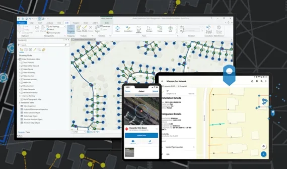
Authoritative data sharing for utilities A System of Engagement - an app-centric approach to connecting people, processes and data - is a key technology pattern that will make a big difference to any electric, gas, water or telecommunications organisation. But how do you know if your organisation has one? Learn more
The four foundations for building a smart city With leaders embracing new technologies to enable their e-Government strategy, it's becoming easier for cities - regardless of their size - to become a 'smart city'. Learn more
Don't let aging technology damage your legacy Legacy technology can be a roadblock for utility providers. Real-time, spatial software can work alongside legacy technology. Geo-enabling the network can create a model for digital transformation for energy infrastructure businesses. Learn more
GIS: the foundation of grid modernisation Discover how GIS technology provides core functionality to help utilities drive their grid modernisation initiatives, and build tougher, smarter and more secure grids. Learn more
The rise of smart cities New, better ways of governing are emerging from cities as they strive to become more liveable and sustainable places. Learn more
The tech behind smart government The old ways of governing are fading; and the smarter way of governing is not about excuses - it's about open data and real results. Learn more
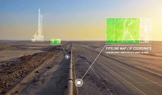
APA's playbook for pipeline and gas utilities Discover how APA Group rapidly designed and deployed a whole-of-organisation geospatial platform creating instant access to data and insights - and for the first time, a consistent cloud-based approach. Learn more
Sustaining oil and gas production for economic recovery Read the Q&A with leaders from the oil and gas industry to hear insights on how resources organisations can leverage geospatial technology to meet the unprecedented challenges presented by COVID-19. Learn more
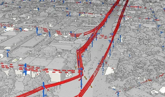
Replacing 50,000 man hours with AI Discover how one utility implemented a state-of-the-art approach to detecting overhead powerlines with deep neural networks. Learn more
One easy way to maximise the return from legacy utility systems The biggest challenge electric utilities face within their operations is dated technology. Most consider the process too problematic: replacing legacy systems often incurs far-reaching disruptions. But it doesn't have to be this way. Learn more
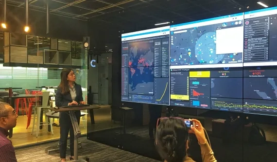
GIS lessons learned during the COVID-19 pandemic The launch of Esri Malaysia's COVID-19 GIS Hub website provided important geospatial insight in the management of the disease. Learn more
Driving an Enterprise GIS with strategic rebranding How rebranding job titles and department names can help you change your image from mapmaker to enterprise IT solution provider. Learn more
Navigating the path from GIS manager to GIS leader Over the last 10 years the role of GIS manager has transformed from managing a team of GIS practitioners to an enterprise IT system leader enabling others to use GIS to make better decisions. Learn more
A business guide to AI and location intelligence Business executives, pressed to deliver on strategic goals like market growth and risk mitigation, find important context in combining artificial intelligence with location intelligence technology. Learn more
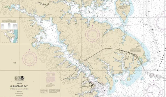
Digitalising navigational charts for safety NOAA is leading the world in phasing out paper charts, embracing the advantages of Electronic Navigational Charts. Learn more
How mapping technology can help catch killers Mike King outlines how investigators can use Geographic Information System (GIS) technology to combine location-based data, public information and suspect profiling data, to help catch killers. Learn more
Coronavirus: What you need to know Esri's Chief Medical Officer - Dr. Este Geraghty - shares a collection of the most up-to-date and authoritative resources on COVID-19 to help you stay informed and prepared during this emergency. Learn more
8 lessons from BP's global GIS digital transformation With a small budget and only five people working to start the platform, BP implemented a global enterprise GIS that enables greater collaboration, deeper insights and faster decision making. Learn more