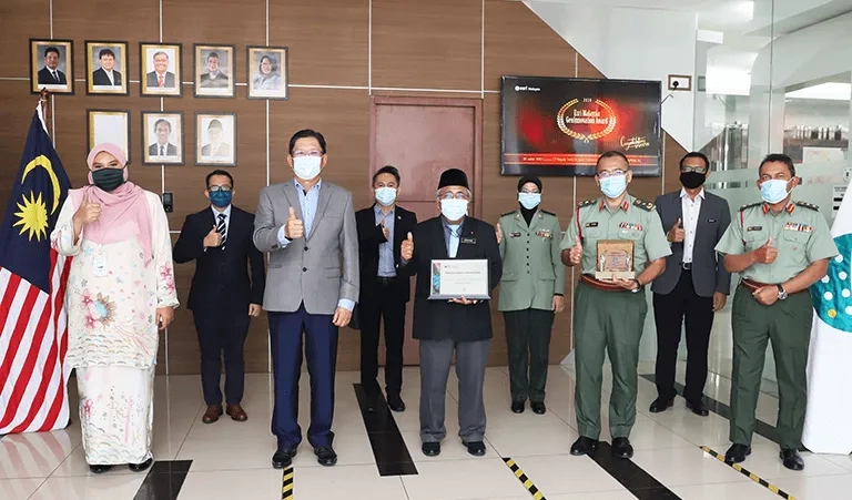
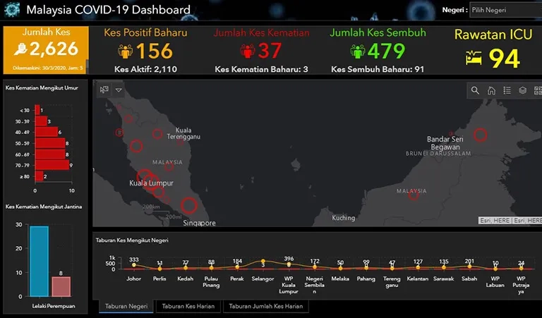
You are here News and events News News Search news Search by year All202620252024202320222021202020192018201720162015201420132012 Tags - Any -3DABSAECAgileAgribusinessAgricultureAnalyticsAppsAppStudioArcGISArcGIS 10.5ArcGIS 10.6ArcGIS EnterpriseArcGIS HubArcGIS IndoorsArcGIS MonitorArcGIS OnlineArcGIS ProArtificial intelligenceAsset managementAugmented realityAustralian Bureau of StatisticsAutodeskBankingBIBig DataBig Data AnalyticsBIMBorder PatrolBusinessBusiness IntelligenceCadastreCalifornia CoastlineCitizen engagementCloudCloud computingCloud GISCollectorCommercialCommercial propertyCommunityContentCoronavirusCouncilCOVID-19CrisisCrowdsourcingDataData analyticsData visualisationDeep learningDefence and intelligenceDekhoDesignDigital transformationDisruptive appsDronesE-governmentE-IdamanEducationEISBeLearningElectionElectorateElectricElectricityEmergency managementEmergency responseEmergency servicesEMUC 2018 - AdoptEMUC 2018 - Afternoon plenaryEMUC 2018 - DeepenEMUC 2018 - ExtendEMUC 2018 - PlenaryEMUC 2019 - ExtendEnergyEnergy, oil, gas and renewablesEngineeringEnterprise GISENVIEnvironmental managementEsriEsri AustraliaEsri MalaysiaEsri Petroleum ConferenceEsri UCEsri Young Scholars AwardEventsFederal governmentFinancial institutionsFinancial servicesFood securityForestryForresterGasGDA2020GDA94Geo hubGeoAIGeoAnalyticsGeographic datumGeographic Information SystemsGeoInnovation AwardGeoInnovation AwardsGeospatial AnalyticsGISGIS for healthGIS for schoolsGIS in land administrationGIS in Telecommunications - featureGIS managerGIS server softwareGIS technologyGIS web servicesGovernmentHealthHealth and human servicesHomeland SecurityIcon WaterIDLImageryImpact AwardsIndoor navigationInnovationInsights for ArcGISInsuranceInsurance and BankingInteractive mapsInternet of ThingsInternshipInteroperabilityIoTJack DangermondJavaScriptKerajaan Negeri SembilanLand AdministrationLand managementLaura DangermondLaw enforcementLive dataLive sensorsLocal governmentLocation intelligenceLocation-based analyticsLogisticsMachine learningMappingMapping and chartingMapsMaritimeMediaMicrosoft AzureMiningMobileMobile applicationsMobile GISMount AgungMRT CorpNational developmentNational SecurityNot for profitOH&SOiloil & gasOpen dataOpen platformOperational awarenessOz MineralsOzriPartnershipPetroleumPETRONASPlanningPortsPredictive analysisProductsPublic safetyPublic sectorQueensland GlobeRaster dataReal-time analyticsRemote sensingResilient communitiesResourcesRetailROISaaSSabah Lands and Surveys DepartmentSafe communitiesSAG AwardsSAPSAR ImagerySARscapeSatellite imagerySensorsSmart citiesSmart communitiesSmart transportSmarterWXSoil healthSolar eclipseSpatial data infrastructure solutionsSpeculative designStartupsState governmentStory mapsSupply chain managementSurvey123Sustainable developmentTelcoTelecommunicationsTrainingTransformationTransportTransport analyticsTransport and InfrastructureTransportationUIUnearthed ChallengeUnited NationsUnmanned Aerial VehiclesUrban analyticsUrban planningUser experienceUser interfaceUser researchUtilitiesUtility networkUXUXGVirtual realityWaterWaterfallWeb GISWHOWorking lands Mapping health: How geography drives Malaysia's health strategy Discover how Malaysia’s Ministry of Health uses geospatial technology to optimise planning, target resources, and enhance national health care strategy. Learn more Modernising electricity grid planning with geospatial technology Explore how Tenaga Nasional Berhad (TNB) uses ArcGIS-powered GeoLVI platform to modernise electricity grid planning, optimise land acquisition, and accelerate infrastructure projects across Malaysia. Learn more Innovating efficient and green construction with GIS Discover how ACCIONA leverages ArcGIS online to transform engineering projects, cutting cost, boosting collaboration, and accelerating the shift to a low-carbon future. Learn more News Honoring Excellence in GIS: Malaysian Geospatial Innovations Shine at Industry Awards Discover how spatial technology drives sustainable, efficient solutions, as showcased by Malaysia’s top innovators at the Esri Malaysia GeoInnovation Awards and Conference. Learn more News Malaysian organisations innovating with GIS celebrated globally Three pioneering organisations were recognised at the 44th annual Esri User Conference in San Diego, for their vision and sophisticated application of GIS technology. Learn more News GeoInnovation Awards 2024 crown innovative applications Five organisations were recognised for implementing innovative GIS solutions across a number of industries that serve the country and its local communities. Learn more News Celebrating innovation in GIS application Malaysian organisations were recognised at the 43rd annual Esri User Conference in San Diego. Learn more News Industry awards recognise Malaysian geospatial innovation Four Malaysian commercial and government organisations have implemented a dynamic platform to record, engage and understand data through geospatial technology; improving business impact across waste, land, resource and highway management. Learn more Land & Survey Departament Sarawak, Sime Darby Plantation, MBIP recognised at world’s largest geospatial technology event Land & Survey Department Sarawak, Sime Darby Plantation Research Sdn. Bhd., and Majlis Bandaraya Iskandar Puteri were selected from over 300,000 organisations worldwide to receive global technology giant Esri’s Special Achievement in GIS (SAG) Award. Learn more Digital transformation stands centre stage at GeoInnovation Awards Learn more SWCorp embraces digital transformation to reach 40% recycling target by 2025 Learn more GeoInnovation Awards recognises use of geospatial technology in COVID-19 pandemic Learn more JUPEM recognised for innovatively managing the COVID-19 pandemic Learn more PETRONAS wins 2020 SAG Award Learn more Esri named a leader in location intelligence platforms report Learn more Esri partners with WHO as part of COVID-19 response Learn more Location intelligence maps COVID-19 in real-time Learn more PETRONAS and E-Idaman are recognised for geospatial innovation Learn more Salesforce selects Esri as key geospatial partner Learn more GIS Day 2019: It's now easier to be a Smart City Learn more Load More
Mapping health: How geography drives Malaysia's health strategy Discover how Malaysia’s Ministry of Health uses geospatial technology to optimise planning, target resources, and enhance national health care strategy. Learn more
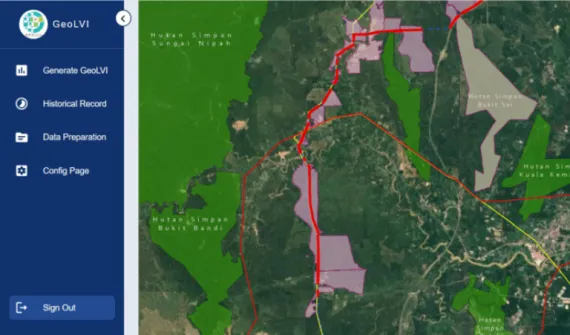
Modernising electricity grid planning with geospatial technology Explore how Tenaga Nasional Berhad (TNB) uses ArcGIS-powered GeoLVI platform to modernise electricity grid planning, optimise land acquisition, and accelerate infrastructure projects across Malaysia. Learn more
Innovating efficient and green construction with GIS Discover how ACCIONA leverages ArcGIS online to transform engineering projects, cutting cost, boosting collaboration, and accelerating the shift to a low-carbon future. Learn more
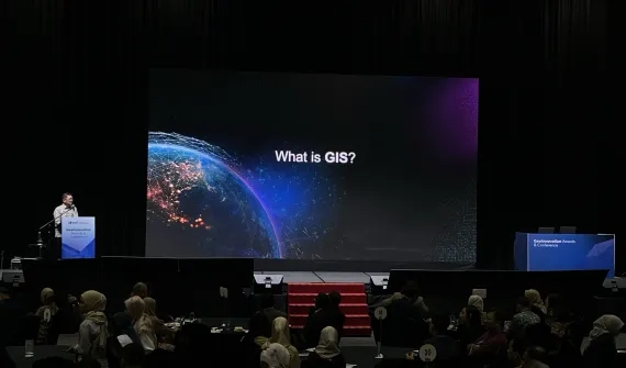
News Honoring Excellence in GIS: Malaysian Geospatial Innovations Shine at Industry Awards Discover how spatial technology drives sustainable, efficient solutions, as showcased by Malaysia’s top innovators at the Esri Malaysia GeoInnovation Awards and Conference. Learn more
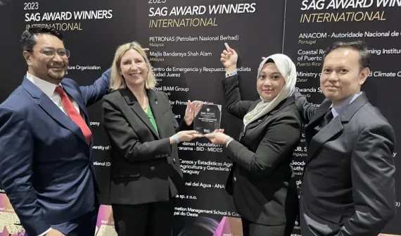
News Malaysian organisations innovating with GIS celebrated globally Three pioneering organisations were recognised at the 44th annual Esri User Conference in San Diego, for their vision and sophisticated application of GIS technology. Learn more
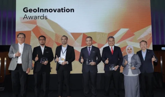
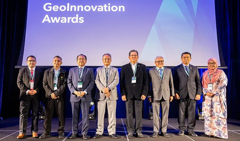
News GeoInnovation Awards 2024 crown innovative applications Five organisations were recognised for implementing innovative GIS solutions across a number of industries that serve the country and its local communities. Learn more
News Celebrating innovation in GIS application Malaysian organisations were recognised at the 43rd annual Esri User Conference in San Diego. Learn more
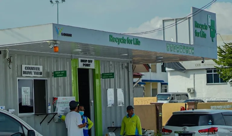
News Industry awards recognise Malaysian geospatial innovation Four Malaysian commercial and government organisations have implemented a dynamic platform to record, engage and understand data through geospatial technology; improving business impact across waste, land, resource and highway management. Learn more
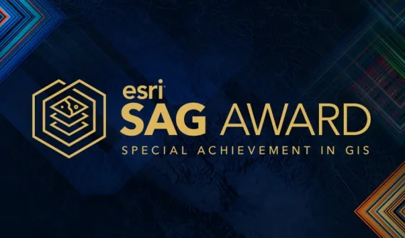
Land & Survey Departament Sarawak, Sime Darby Plantation, MBIP recognised at world’s largest geospatial technology event Land & Survey Department Sarawak, Sime Darby Plantation Research Sdn. Bhd., and Majlis Bandaraya Iskandar Puteri were selected from over 300,000 organisations worldwide to receive global technology giant Esri’s Special Achievement in GIS (SAG) Award. Learn more