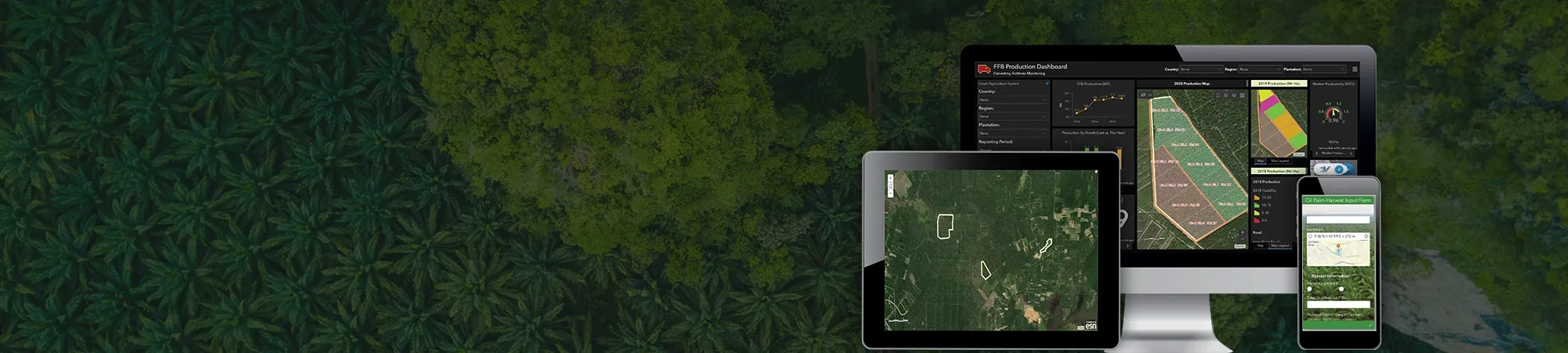
Increasing crop yields and profits, all through one platform
The challenges of each plantation may vary and not always require an all-encompassing approach. After rigorous industry research and market analysis, the Geo-Precision Agriculture Solution was developed to address these different needs.
Leveraging Esri’s world-leading ArcGIS platform, it can be seamlessly integrated into operations and features a set of modules designed to reduce costs while improving ROI, while optimising collaboration between departments and teams – even when they’re out in the field.
Overview of solution
Learn what the different modules can offer: From addressing key plantation business needs to providing actionable insight towards analysing trends and patterns in your harvests.
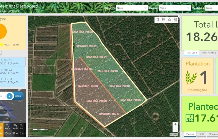
Area Statement
In a single dashboard view, a master record of landbank utilisation and planting profile data is displayed.
Soil type and characteristics can also be tracked, while weather patterns like rainfall and drought periods can be monitored to predict risks and vulnerability.
Staff onsite will be linked to the online maps and its data through the in-field mobile app, which allows all findings to be noted on the map while online or off and shared within the team.
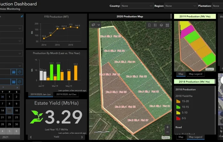
FFB Production
Using the configurable form-centric Bunch Chit Mobile App, staff on the ground can create, capture, analyse and input different forms of harvest data.
GPS data and site photos are also submitted digitally and securely to the FFB Production Dashboard, while will also display key production indicators.
In addition, harvesting insights are provided by monitoring and comparing current production levels to the previous year’s output, as well as the harvester turnout rate, rainfall, soil types, and more.
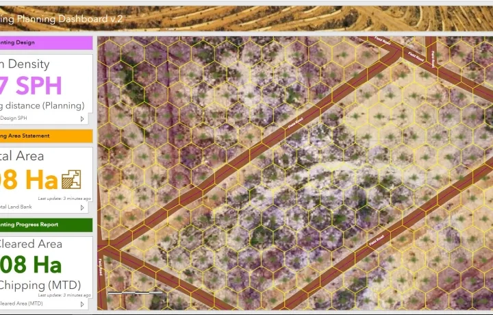
Replanting Planning
Leveraging on advance drone technology for aerial visualisation and analysis, baseline data is displayed for better preparation and planning of replanting design elements like terraces, roads, and planting density.
Before the actual replanting, pre-design stage planning can begin as early as a year in advance by analysing your drone images.
Much easier and more affordable to deploy than surveys done by helicopter, aerial photo processing by drones can capture thousands of field images quickly for future audits.