Modernise your valuation assessments with e‑government GIS tools
The Local Government Property Valuation Assessment Package is a set of spatial technology tools that helps assessors to automate and optimise traditional land valuation workflows.
The package enables seamless field data collection and sharing; makes it simpler to detect errors, anomalies and gaps in data; provides a real-time snapshot of inspection works and workforce updates; improves visibility of current tax collection information; and helps engage and inform taxpayers and other business partners on assessment data.
Tools included in the package:
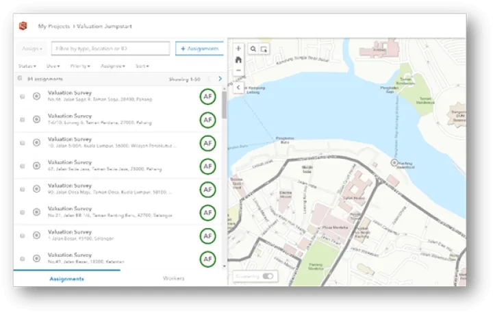
Field Force Manager
Learn more
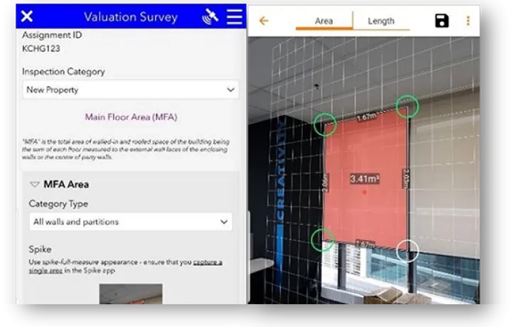
Field Inspection
Learn more
Quality Control
Learn more
Valuation Modelling
Learn more
Collection Monitoring
Learn more
Valuation Survey Workforce Dashboard
Learn morePublic Data Access
Learn moreKeen to learn more? Contact our team of technology specialists to discover how to get started.
The Local Government Property Valuation Assessment Package includes these tools:
Field Force Manager
Improve coordination and the operational efficiency of workforce activities by empowering field officers with the capability to easily optimise resources, assign tasks, and manage productivity for in-field inspections.
Field Inspection
Eliminate paper-based inspection methods in the field by utilising mobile devices. Data can be synced to a centralised location ensuring access anywhere, anytime, on any device. This application is integrated with Spike ikeGPS devices to ensure seamless and convenient measurement inspection – without the need for traditional measuring tapes.
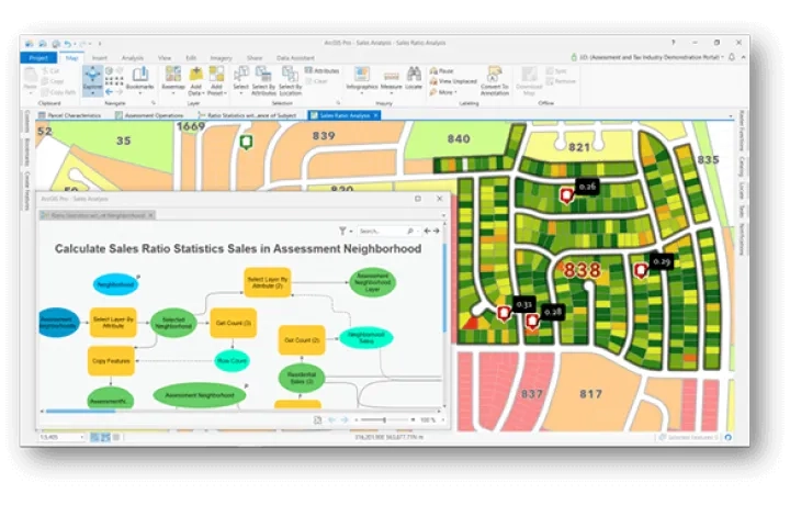
Quality Control
Identify trends and patterns such as detecting outliers and anomalies, and vertical/horizontal equities.

Valuation Modelling
Use advanced spatial analytics to build a complete valuation analysis model with outputs such as rateable value and annual value.
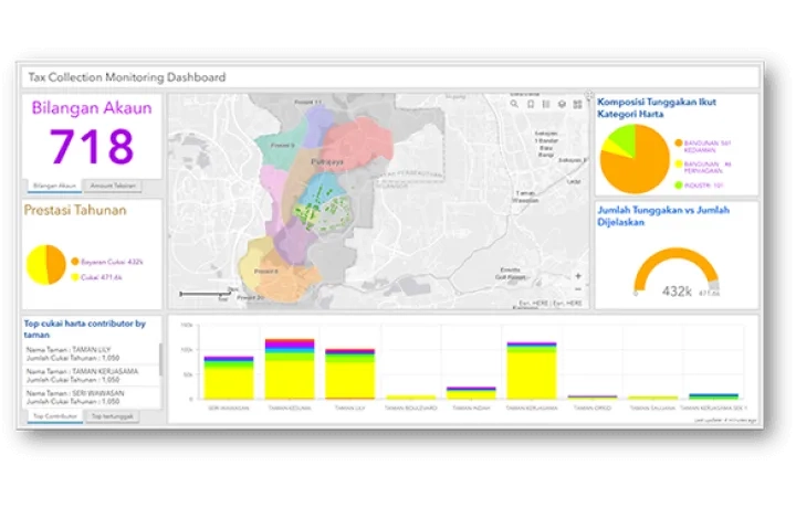
Collection Monitoring
An all-in-one screen status report that provides users with updated information on tax collection. The application can be easily accessed on any device to support more efficient tax collection monitoring.
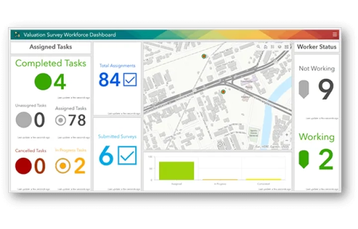
Valuation Survey Workforce Dashboard
Access real-time monitoring via an all-in-one dashboard to quickly view the progress of inspection works and workforce updates.
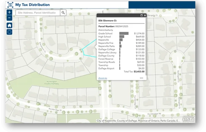
Public Data Access
Facilitate citizen engagement and public transparency to gain taxpayer’s trust by displaying relevant information on tax distribution and valuation process through intuitive self-service tools.