Five of the country’s most progressive organisations were recognised at the Esri Malaysia GeoInnovation Awards and Conference on November 14, demonstrating the force multiplier effects of spatial analytics.
The Conference featured in-depth presentations on the customised digital infrastructure enabled by the Esri stack, revealing previously unknown workflows and datasets that are now being leveraged to make data-driven decisions.
Planning Division, Ministry of Health
To ensure expansive healthcare coverage across public and private sectors, Planning Division, Ministry of Health is championing an innovative solution – Malaysia Health Supply & Demand Solution Hub (S&D) leveraging GIS technology of the Malaysian Health Data Warehouse.
By harnessing Esri’s spatial expertise, S&D aims to pinpoint healthcare gaps and streamline resource allocation to meet the needs of future demand of Malaysia healthcare.
More than 10,000 health experts – including doctors, nurses, dentists and pharmacists – collaborate and visualise healthcare supply and demand data to gain a spatial perspective of the needs of their practices.
By visualising disparities in health services, S&D provides a comprehensive solution to determine demographic trends, disease burden and anticipate resource needs across both rural-urban regions and public-private facilities in the country.
Majlis Bandaraya Iskandar Puteri
The project – Malaysia’s first GIS-based public participation solution - aims to enhance citizen engagement in local planning by leveraging Esri’s geographic information systems (GIS).
By launching the Publisiti Awal RTIP 2023 site within One Map MBIP, the local planning authority utilised advanced GIS tools such as citizen crowdsourcing, geography-based surveys and dashboards to facilitate public participation.
This cutting-edge solution addresses previously low engagement rates in urban planning projects. The platform enhances accessibility by providing interactive and digital communication tools for the community to voice their opinions.
As a result, public involvement has increased significantly, from 0.6% of the overall population using traditional citizen engagement methods, to 314.5% with the GIS-based engagement solutions.
This has fostered a more inclusive and effective planning process that better reflects the needs and aspirations of Iskandar Puteri’s citizens.
Additionally, the Publisiti Awal RTIP 2023 site within One Map MBIP has reduced the average cost per engagement from MYR 5.99 to just MYR 1.70.
Majlis Bandaraya Johor Bahru
With a population of over 850,000 and spanning more than 370 square kilometres, Majlis Bandaraya Johor Bahru (MBJB) needed a digital solution to strenghten connections with its citizens. To achieve this, the interactive dashboard, GeoJB Portal was built to monitor dengue fever cases, food & beverage premises grading, and public toilet audit.
As a result, dengue fever cases saw a dramatic 51% reduction from 4,742 cases in 2020 to 2,278 in 2023, thanks to timely fogging within a 200-meter radius of reported cases, facilitated by visualising hotspots with the GeoJB portal.
Additionally, the grading of food and beverage premises, accessible via the GeoJB Portal's Open Data Gallery, has empowered the public to make informed choices and motivated license owners to improve their hygiene standards.
By enabling real-time data analysis and public awareness, MBJB can respond swiftly and take measured action to vector control, hygiene standards, and improve public health outcomes.
Pengurusan Air Selangor
Pengurusan Air Selangor, wholly owned by the Selangor State Government and Malaysia's largest water operator, supplies clean and treated water to approximately 9.62 million customers.
Leveraging an extensive network of assets—including 34 water treatment plants, over 1,600 reservoirs, and a 31,000+ km pipeline with 2.6 million connections—Air Selangor serves the residents of Selangor, Kuala Lumpur, and Putrajaya.
To improve communication and data sharing across its operations, Air Selangor implemented a GIS-based solution, the 'd15+ Project.'
Developed within five months, the project produced 15 applications and will expand through 2026 to support data management, regulatory compliance, infrastructure planning, and field data collection.
By equipping staff with the necessary tools and training, the d15+ Project fosters real-time decision-making, cultural transformation, and strategic data collaboration across the organisation.
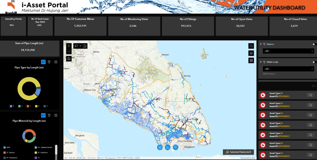
Ranhill SAJ

Operating 46 water treatment plants across Johor state, with a total plant capacity of 2.1 million litres a day, Ranhill SAJ required a spatial solution to seamlessly generate water asset reports.
To streamline the process and integrate the GIS solution with existing systems forbilling, water quality, job tracking and remote monitoring, Ranhill SAJ migrated to a new Esri-driven Utility Network.
The application communicates via a centralised GIS system, enabling unified data sharing, enhancing asset recording and tagging, improving data visualisation, and facilitating real-time decision-making.
This digitisation process allows for efficient data sharing across the organisation and reduces time and costs associated with manual processes, such as printed maps.
If you would like more details or have any questions, please contact the media team.
