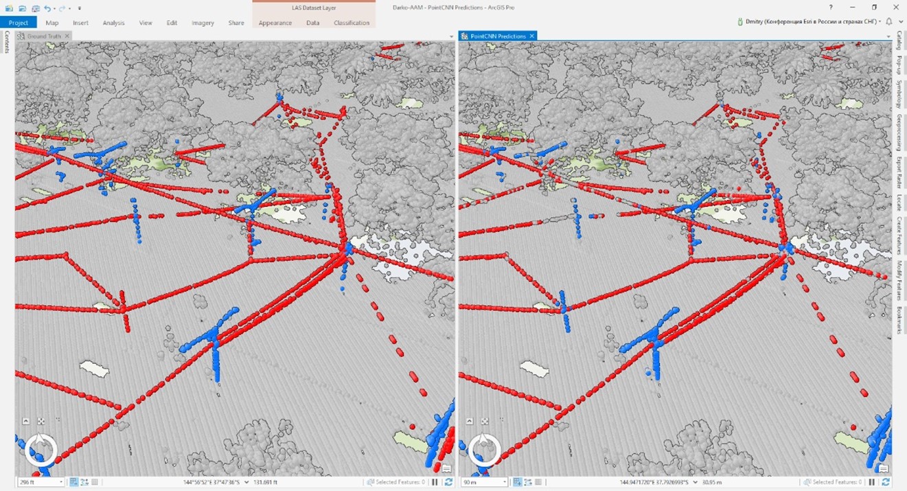
A state-of-the-art approach to detecting overhead powerlines with deep neural networks.
To ensure the safety of both transmission and distribution networks, electric utilities must monitor for encroachments from vegetation or other structures. Without completing this vital work, a single tree branch can lead to a fire or power outage affecting thousands of customers.
To identify encroachments, the entire grid is surveyed by planes or drones equipped with LiDAR sensors. Once the point cloud is captured, powerline points are manually labelled within a GIS and any encroachments are detected and sent to a field team to address.
However, the manual labelling of the powerlines in raw point clouds is a time-intensive and laborious procedure: one utility required 50,000-man hours a year to manually tag the points belonging to overhead conductors.
Can deep neural networks help?
Training a deep neural network model – such as PointCNN – allows for efficient assignment of classes. For example, assigning buildings, vegetations or water – to raw point clouds. However, detecting overhead wires in urban areas may prove more challenging. Firstly, overhead wires tend to have a vanishingly small number of points. Secondly, the wires may be difficult to discern from their surroundings.

Given these challenges, you may not expect that a deep neural network could learn general rules to be able to detect and label overhead powerlines. But the results from an Esri experiment with PointCNN showed that well trained models can detect powerlines – even in complex environments with lots of trees.

What do I need to train a deep neural network?
In the above example, running the analysis requires a good GPU and a large video RAM. It’s also worth noting that the more high-quality the training data, the better – in the world of deep learning, experiments on larger datasets make the neural network model even more efficient.
In this short overview, we can see that AI has many uses – and the use of deep neural networks may enable more efficient and reliable infrastructure checks, leading to improved safety for electric utilities.
An earlier version of this article first appeared in Medium GeoAI.
If you’re looking to get started extracting features and assets from point clouds, such as wires and poles from airborne LiDAR, watch the demo or book a consultation with a utilities specialist.

