Rapidly deployable e-government apps for smarter cities
The Smart Government Program is a set of ready-to-deploy, focused e-government applications that help local governments optimise critical workflows and provide a 360-degree view of city operations and KPIs.
Developed using Esri’s world-leading GIS technology to meet the specific needs of Malaysia’s local government community, the Program seamlessly integrates into your operations to ensure efficient, rapid deployment.
Kickstart a Smart Local Government program for your city – contact our team of technology specialists to learn more and get started.
The Smart Local Government Program includes 5 key e-government applications:
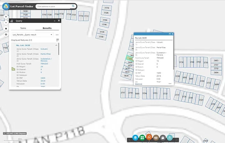
Lot Parcel Finder
Used by field officers from any device, at any time and from anywhere, the Lot Parcel Finder helps identify land parcels on site or at the planning submission and verification stage.
Reducing the time needed to find lot information from days to minutes, the module helps improve decision-making and drive more efficient data management.
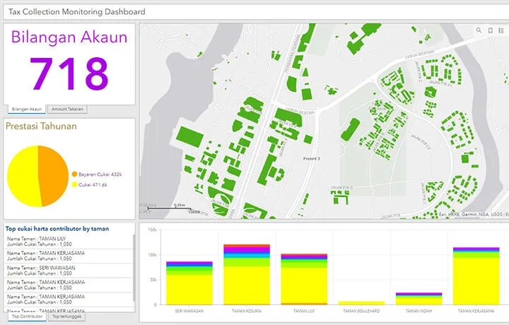
Tax Collection Dashboard
Optimise tax collection with a comprehensive view of your operation at any time, from anywhere.
The module monitors and analyses areas where tax collection can be optimised and scaled for an automated and seamless integration.
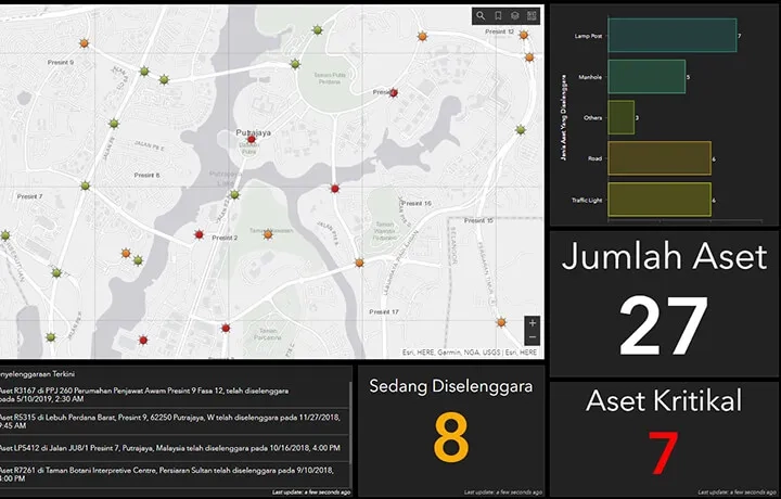
Real-time Asset Management
Use dashboards to combine authoritative asset inventory with business process applications to analyse, optimise and maintain a real-time view of your asset network.
Instantly determine the location and progress of ongoing maintenance in local government areas and prioritise inspections and work-order activities.
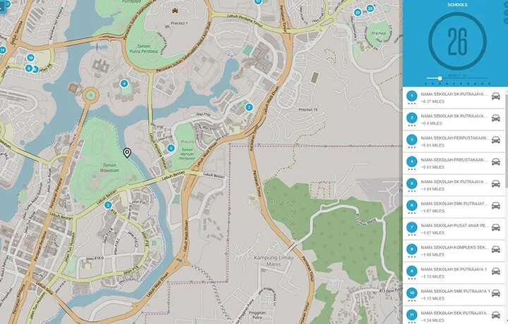
My Government Service
This public-facing solution enables your citizens to easily find nearby local facilities and government services, delivering a convenient self-service that helps improve their quality of life.
Government initiatives can be made public to demonstrate transparency and accountability and increase community engagement – citizens can watch a project come to life in context of their community.
City Profiler
Keep the public informed and engaged by presenting government initiatives using data, text, images, multimedia content and map-based visualisations.
Deliver better visualisations of government strategy to the public and create communities that are inclusive, sustainable and prosperous.