You are here About GIS technology Esri map gallery Esri map gallery Have a look at these GIS maps from Malaysia and around the world to see how others are sharing information via smart mapping technology. Select an industry All industriesAgriculture and plantationArchitecture, engineering and constructionDefence and intelligenceEducationElectricityEmergency managementGovernmentHealth and human servicesInfrastructure and public worksInsurance and bankingLand administrationLaw enforcementManufacturingMining and petroleumNational securityNatural resourcesNon-profitOil, gas and renewable energyRetailSafe communitiesSmart communitiesSpatial data infrastructureTelecommunicationsTransport and logisticsUtilitiesWater Select a region All regionsAfricaAsiaAustraliaEuropeInternationalNorth AmericaSouth America Select a subject All subjectsBusinessCommunityCultureDesignDevelopmentDisasterFarmingHistoricalHumanitarianIn the newsNaturePoliticsScienceSpaceTechnologyTravelUrban planningVirtual reality Singapore OneMap Developed by the Singapore Land Authority, the Singapore OneMap is an application that allows users to search and navigate intelligently for places of interest such as museums, hawker centres, childcare services, parks and sports centres. Explore Sea tourism in Indonesia Drift among the 17,000 islands that lay at the heart of the world-renowned 'coral triangle', and learn about the most beautiful aquatic locations in Indonesia. This map makes it easy to plan for your next vacation! Explore Public health preparedness When public health is threatened, public health professionals and agencies need to respond quickly and make timely decisions that will improve overall health security and minimise consequences. Explore MH370 one year on: what we know A year on from the disappearance of Malaysia Airlines flight MH370, this interactive story map follows the timeline of events and the steps being taken by authorities to solve the mystery. Explore Growth from the ground up Learn more on the importance of green infrastructure amid today's urban developments, and discover how communities stand to benefit from reversing the traditional order of planning. Explore Flying high in the Indonesian sky Follow Saleh Sudrajat's 5,000-kilometre journey across Indonesia - from Sabang to Merauke - in an ultralight trike that could facilitate access to disaster areas and expedite emergency service delivery across the nation. Explore Ebola outbreak map An interactive map of the history of Ebola - from the first known case in the Democratic Republic of the Congo in 1976, to the ongoing crises in Guinea, Liberia, Sierra Leone, Nigeria and throughout the rest of the world. Explore Balikpapan oil spill incident: a tragedy for the ecosystem The biggest oil spill in Balikpapan Bay East Kalimantan significantly affected the marine ecosystem as well as coastal residents. Esri Indonesia created a dynamic 3D map to promote greater awareness of the incident. Explore Archipelago flavours Don't view this story map on an empty stomach! Tour the islands of Indonesia and let your mouth water as you learn about the famous and diverse local dishes that shape one of the most colourful cuisines in the world. Explore Pagination First page « First Previous page ‹ Previous Page 1 Page 2 Current page 3 Page 4 Next page Next › Last page Last »
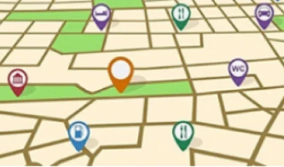
Singapore OneMap Developed by the Singapore Land Authority, the Singapore OneMap is an application that allows users to search and navigate intelligently for places of interest such as museums, hawker centres, childcare services, parks and sports centres. Explore
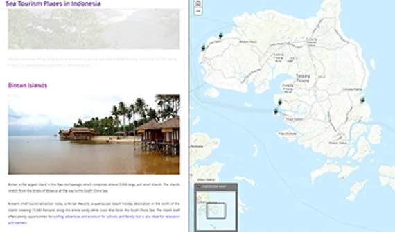
Sea tourism in Indonesia Drift among the 17,000 islands that lay at the heart of the world-renowned 'coral triangle', and learn about the most beautiful aquatic locations in Indonesia. This map makes it easy to plan for your next vacation! Explore
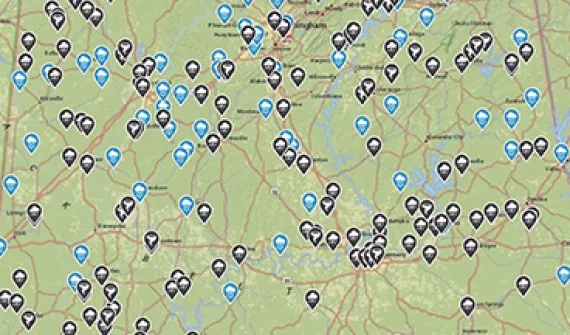
Public health preparedness When public health is threatened, public health professionals and agencies need to respond quickly and make timely decisions that will improve overall health security and minimise consequences. Explore
MH370 one year on: what we know A year on from the disappearance of Malaysia Airlines flight MH370, this interactive story map follows the timeline of events and the steps being taken by authorities to solve the mystery. Explore
Growth from the ground up Learn more on the importance of green infrastructure amid today's urban developments, and discover how communities stand to benefit from reversing the traditional order of planning. Explore
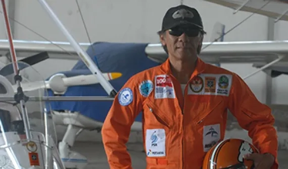
Flying high in the Indonesian sky Follow Saleh Sudrajat's 5,000-kilometre journey across Indonesia - from Sabang to Merauke - in an ultralight trike that could facilitate access to disaster areas and expedite emergency service delivery across the nation. Explore
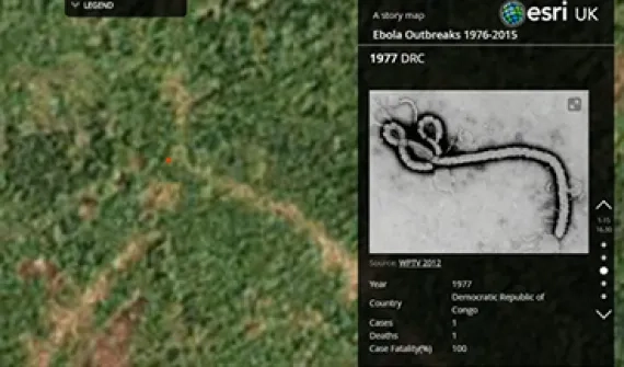
Ebola outbreak map An interactive map of the history of Ebola - from the first known case in the Democratic Republic of the Congo in 1976, to the ongoing crises in Guinea, Liberia, Sierra Leone, Nigeria and throughout the rest of the world. Explore
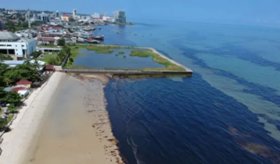
Balikpapan oil spill incident: a tragedy for the ecosystem The biggest oil spill in Balikpapan Bay East Kalimantan significantly affected the marine ecosystem as well as coastal residents. Esri Indonesia created a dynamic 3D map to promote greater awareness of the incident. Explore
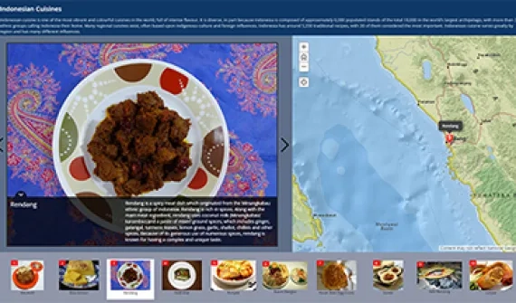
Archipelago flavours Don't view this story map on an empty stomach! Tour the islands of Indonesia and let your mouth water as you learn about the famous and diverse local dishes that shape one of the most colourful cuisines in the world. Explore