Celebrating the geospatial solutions that have been used to improve and solve Malaysia’s social, economic, business, and environmental challenges.
The GeoInnovation Awards commemorate organisations in the country for their innovative approaches towards helping industries and communities address real-world challenges.
In addition to receiving this accolade, some winners will be providing a short presentation on their solutions – the motivations, challenges, and processes that inspired their forward-thinking approach, as well as its outcomes.
Program
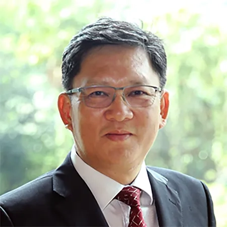
- 9:30am | Welcome address
Speaker
CS Tan, Chief Executive Officer, Esri Malaysia
Abstract
Esri Malaysia's CEO, CS Tan, shares his insights on how geospatial technology has been – and will continue to be – essential in preparing communities to be more resilient, especially in adapting to the new normal.
- 9:40am | Innovative use of geospatial technology to manage COVID-19 pandemic
Speaker
Dato’ Sr DR. Azhari Bin Mohamed, Ketua Pengarah Ukur Dan Pemetaan Malaysia, Jabatan Ukur dan Pemetaan Malaysia (JUPEM)
Abstract
With a focus on national security, the Department of Survey and Mapping Malaysia’s (JUPEM’s) Defence Geospatial Division (BGSP) expanded its role towards providing support for the government’s initiatives in managing the pandemic. A COVID-19 digital hub was developed – a single platform that provides a common view for all agencies to collaborate on and monitor one another’s operations. On-ground teams also provide real-time updates through mobile apps, delivering deeper COVID-19 insights for greater awareness and preparedness to all involved.
- 9:55am | Geospatial Analysis to Inform Public Health Decision Making in Malaysia
Speaker
Dr Hammad Fahli bin Sidek, Senior Assistant Director, Ministry of Health
Abstract
The Malaysian Health Data Warehouse (MyHDW) is a national healthcare information gathering and reporting system that covers all government and private sectors. Established as a response to changing trends in demographic and disease patterns, MyHDW is an integrated and accessible platform which preserves data privacy and confidentiality. The integration between MyHDW and GIS allows a consolidated view of geospatial data related to the national healthcare system for better and informed decision making.
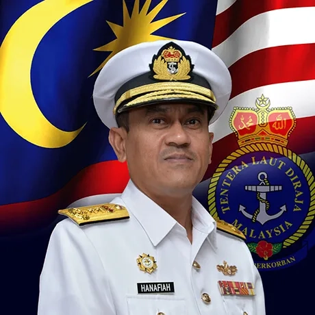
- 10:10am | Maritime Chart Service
Speaker
Rear Admiral Dato' Hanafiah bin Hassan, Ketua Pengarah Hidrografi, Pusat Hidrografi Nasional
Abstract
The National Hydrographic Centre (PHN) has made great strides in recent years to develop its Marine Spatial Data Infrastructure (MSDI). However, its data platforms at the time were unable to adapt to and accommodate this growth. This was made additionally cumbersome as data was shared via CDs between the maritime agencies, limiting collaboration between them. To overcome these challenges, PHN tapped into GIS to create the MyMarine GeoHub – a portal that houses extensive data types ranging from seabed bathymetry to infrastructure, as well as administrative and legal boundaries, conservation, marine habitats, and oceanography. By having a common point of reference, processes and workflows among the maritime agencies were greatly optimised, with time taken for data sharing and chart production reduced by one to two days.
- 10:50am | SWCorp Vision around the GIS Inventory
Speaker
Ir. Zulkifli bin Tamby Chik, Pengarah Bahagian Penyelidikan dan Teknologi, SWCorp Malaysia
Abstract
SWCorp's WEGIS portal is a testament to its commitment towards a sustainable solid waste management system. By digitising its manual workflows and processes, the reliance on paper-based files and records have been greatly reduced. In doing so, this has also diminished data loss from missing hardcopies and ensured no data duplication and redundancy. Through its user-friendly interface, all user levels and access among Malaysia’s regulatory authorities can easily cross-reference up-to-date and accurate data, whether spatial or non-spatial, which can be visualised and presented for greater comprehension.
- 11:00am | Open forum & discussion
Your opportunity to learn more about these award-winning projects from the presenters themselves, as well as to find out how else GIS can help support your business needs.
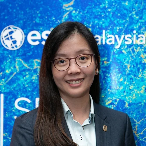
- 11:25am | Closing remarks
Speaker
Joanne Loh, Chief Technology Strategist, Esri Malaysia
Abstract
A recap on our four presenters, as well as an update on some of the exciting programmes planned in the months to come.