This invitation-only forum brought together Malaysia’s industry leaders, to explore how the most progressive organisations used geospatial technology, Machine Learning and Artificial Intelligence to streamline their operations and identify new opportunities.
We also looked at how GIS platforms are being used as the foundational technology from which many organisations are driving their digital transformation and Industry 4.0 initiatives.
- Explored the latest trends in GIS technology
- Learned from the GIS successes of industry leaders such as Petronas
- Heard a first-hand account about how GIS was used to provide critical situational intelligence to inform the Thamluang Cave Rescue Mission
- Discovered how GIS can streamline key operational activities
- Expanded professional networks – brought together like-minded executives who embrace the power of GIS
Presentations

Please get in touch with us if you would like to explore any of the ideas and themes presented at the Esri Malaysia Senior Leaders Forum.
Meet the Speakers


Abstracts
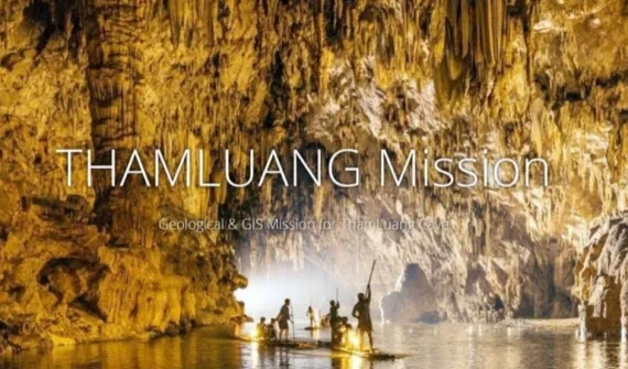
- ThamLuang cave rescue - mapping the impossible path [International keynote speaker] - Songkorn Siangsuebchart, Esri Thailand
One of the most miraculous news stories of 2018 was the successful rescue of 12 young footballers and a coach from the Tham Luang Khun Nam Nang Non cave in Chiang Rai, Thailand. With technically complex conditions including constrained passageways, rising murky flood waters and diminishing oxygen, grave hopes were held for the boys, who were trapped four kilometres inside the “cave of the reclining lady”.
This presentation will provide a behind-the-scenes view of the mission, outlining how the use of advanced location intelligence ultimately helped to save the young boys. It will explore how technical GIS specialists from Esri Thailand collaborated with the Department of Mineral Resources Thailand (DMR) throughout the rescue – from gathering and analysing topographic, geological and hydrological data within ArcGIS – to creating accurate maps that were used both in the operations centre and by ground teams.
The story of the ThamLuang cave rescue mission will demonstrate the power of GIS and the value of collaboration when unimaginable emergencies arise
- Harvesting business growth using geospatial analytics [International keynote speaker] - Raymond De Lai, Wilmar Sugar, Australia
Wilmar Sugar, Australia's leading sugar and renewable energy company, has been using GIS and location-based technologies across its entire supply chain for over two decades.
This presentation will provide a unique, behind-the-scenes view of how Wilmar Sugar uses GIS from farm to factory, to improve asset management, increase yield and drive profitability. You’ll also learn how Wilmar Sugar uses real-time dashboards to inform decision-making and deliver commercial value.
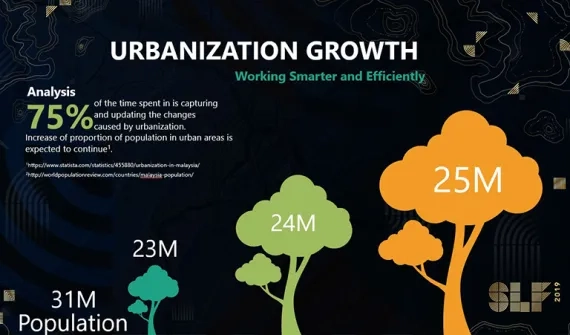
- Exploring the fundamentals of a smart city transformation - TPr. Chew Lee Ting, Iskandar Puteri City Council
This presentation outlines the importance of archiving geographical data in local government – and the change management experience of Iskandar Puteri City Council (MBIP) in migrating to the ArcGIS platform. TPr. Chew Lee Ting will share an update on what One Map 2.0 has achieved to date, as well as a view into the council’s future plans.
One critical change is that MBIP is expanding the use of GIS from its Planning Department to the Landscape and Valuation departments, increasing visibility for key stakeholders. Hear the council’s recommendations into how to kick start map and information sharing amongst in-house teams, and why this approach is fundamental for any Smart City initiative.
- GIS Application for PETRONAS Pipeline Asset Management - Kamaludin bin Hashim & Muhammad Masduki B Abu Samah, PETRONAS Gas Berhad (PGB)
As the custodian of Malaysia’s natural gas and oil resources, PETRONAS places great importance on its asset management strategies. The company has developed a web GIS solution – PiriGIS, that enables key decision-makers to monitor and manage the health of its substantial assets in real-time.
Discover why usability was a key factor in designing this GIS solution, while incorporating an advanced interactive spatial interface and comprehensive technical database integration. You will also see how PETRONAS integrates high resolution imagery and video monitoring taken by drones and helicopters, with live operational data monitoring from SCADA, to streamline operations and monitor geo-hazard threats – to improve the safety and efficiency of its pipeline assets.
- GIS technology trends driving Industry 4.0 - Joanne Loh & Amir Faisal, Esri Malaysia
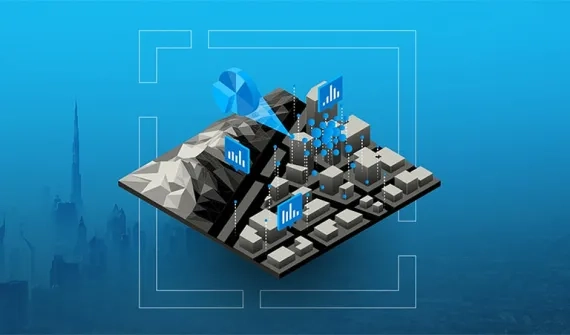
GIS, Machine Learning and Artificial Intelligence are increasingly being used as the foundational technologies from which many organisations are driving their digital transformation and Industry 4.0 initiatives. Combined with this, is the intensifying need to manage huge volumes of disparate data from within and outside of an organisation.
This presentation will explore the latest GIS technology trends, demonstrate how these technologies can deliver maximum business value when rolled out across the enterprise, and provide practical recommendations on how to maximise return on time – and investment – in these technologies. It will also showcase case studies where Industry 4.0 philosophies have been adopted.