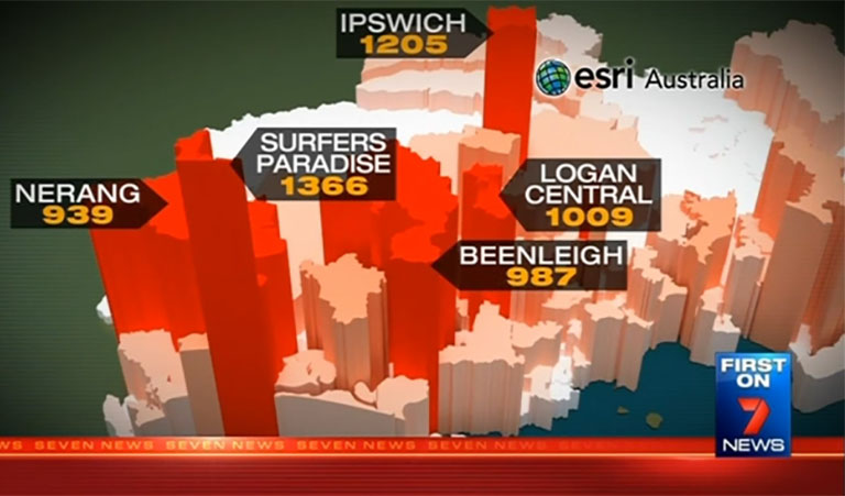
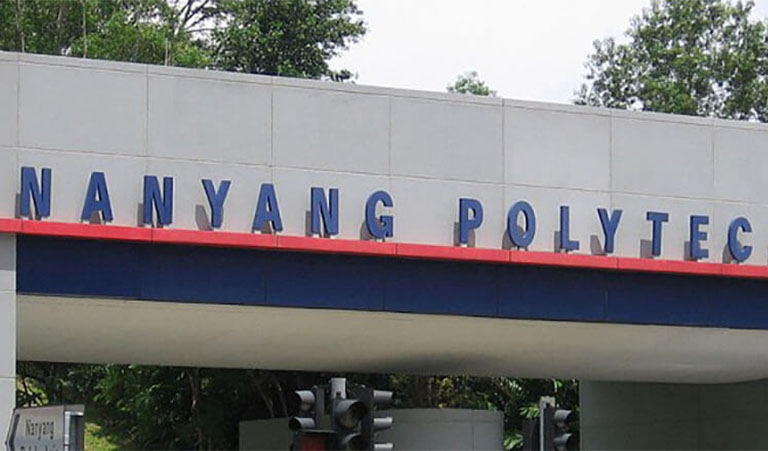
You are here News and events News News Search news Search by year All2024202320222021202020192018201720162015201420132012 Tags - Any -3DABSAECAgileAgribusinessAgricultureAnalyticsAppsAppStudioArcGISArcGIS 10.5ArcGIS 10.6ArcGIS EnterpriseArcGIS HubArcGIS IndoorsArcGIS MonitorArcGIS OnlineArcGIS ProArtificial intelligenceAsset managementAugmented realityAustralian Bureau of StatisticsAutodeskBankingBIBig DataBig Data AnalyticsBIMBorder PatrolBusinessBusiness IntelligenceCadastreCalifornia CoastlineCitizen engagementCloudCloud computingCloud GISCollectorCommercialCommercial propertyCommunityContentCoronavirusCouncilCOVID-19CrisisCrowdsourcingDataData analyticsData visualisationDeep learningDefence and intelligenceDekhoDesignDigital transformationDisruptive appsDronesE-governmentE-IdamanEducationEISBeLearningElectionElectorateElectricElectricityEmergency managementEmergency responseEmergency servicesEMUC 2018 - AdoptEMUC 2018 - Afternoon plenaryEMUC 2018 - DeepenEMUC 2018 - ExtendEMUC 2018 - PlenaryEMUC 2019 - ExtendEnergyEnergy, oil, gas and renewablesEngineeringEnterprise GISENVIEnvironmental managementEsriEsri AustraliaEsri Petroleum ConferenceEsri UCEsri Young Scholars AwardEventsFederal governmentFinancial institutionsFinancial servicesFood securityForestryForresterGasGDA2020GDA94Geo hubGeoAIGeoAnalyticsGeographic datumGeographic Information SystemsGeoInnovation AwardGeoInnovation AwardsGeospatial AnalyticsGISGIS for schoolsGIS in land administrationGIS in Telecommunications - featureGIS managerGIS server softwareGIS technologyGIS web servicesGovernmentHealthHealth and human servicesHomeland SecurityIcon WaterIDLImageryImpact AwardsIndoor navigationInnovationInsights for ArcGISInsuranceInsurance and BankingInteractive mapsInternet of ThingsInternshipInteroperabilityIoTJack DangermondJavaScriptKerajaan Negeri SembilanLand AdministrationLand managementLaura DangermondLaw enforcementLive dataLive sensorsLocal governmentLocation intelligenceLocation-based analyticsLogisticsMachine learningMappingMapping and chartingMapsMaritimeMediaMicrosoft AzureMiningMobileMobile applicationsMobile GISMount AgungMRT CorpNational developmentNational SecurityNot for profitOH&SOilOpen dataOpen platformOperational awarenessOz MineralsOzriPartnershipPetroleumPETRONASPlanningPortsPredictive analysisProductsPublic safetyPublic sectorQueensland GlobeRaster dataReal-time analyticsRemote sensingResilient communitiesResourcesRetailROISaaSSabah Lands and Surveys DepartmentSafe communitiesSAG AwardsSAPSAR ImagerySARscapeSatellite imagerySensorsSmart citiesSmart communitiesSmart transportSmarterWXSoil healthSolar eclipseSpatial data infrastructure solutionsSpeculative designStartupsState governmentStory mapsSupply chain managementSurvey123Sustainable developmentTelcoTelecommunicationsTrainingTransformationTransportTransport analyticsTransport and InfrastructureTransportationUIUnearthed ChallengeUnited NationsUnmanned Aerial VehiclesUrban analyticsUrban planningUser experienceUser interfaceUser researchUtilitiesUtility networkUXUXGVirtual realityWaterWaterfallWeb GISWHOWorking lands Halloween cemetery tour starring history's most notorious Should the dead rise today, which famous person would be on top of your list to meet? Learn more JUPEM recognised internationally for innovative use of mapping technology JUPEM's Defence Geospatial Division (BGSP) has been selected from more than 400,000 organisations worldwide to win a global Special Achievement in GIS (SAG) Award. Learn more Tan Tock Seng Hospital improves patient care with smart mapping Doctors and staff at Tan Tock Seng Hospital (TTSH) are turning to smart mapping technology to design and enhance clinical services for different segments of the population. Learn more News Pertamina EP receives international recognition State-owned oil and natural gas corporation, Pertamina EP, has been selected from among more than 400,000 organisations worldwide to receive a Special Achievement in GIS (SAG) award. Learn more News Advanced geospatial technology to revolutionise national security One of the world's leading geospatial defence experts is in Singapore this week to advise the region's national security stakeholders how state-of-the-art mapping technology can help support mission-critical operations. Learn more News New technology to future-proof Iskandar Malaysia Iskandar leverages state-of-the-art-technology to transform the region into Malaysia's next economic powerhouse and a strong, sustainable metropolis of international standing. Learn more News New tech 'geotriggers' Malaysian shopping Personalised instant alerts triggered by virtual boundaries and sent directly to consumers' smartphones are the new weapon being considered by retailers to gain a competitive edge. Learn more News GIS shapes a brighter future for major electricity utility One of Australia's major electricity providers ensures the reliability and quality of power to a million customers, even in the event of uncontrollable external factors – from bird strikes to bushfires. Learn more Singapore spatial challenge receives international recognition Learn more Heidelberg Cement's global GIS roll-out Learn more Seven News maps driving offence hot spots Learn more 3D technology forges path towards smarter urban planning Learn more NUS student's urban planning project wins tech competition Learn more Real-time mapping delivers new capabilities for Asia's SCM industry Learn more Report sightings of stray cats on OneMap Learn more GIS technology to light up Singapore utility sector Learn more Cracking down on crime with real-time maps Learn more Earth's view unlocked at a touch Learn more GIS a big deal for Big Data Learn more Esri Singapore signs partnership agreement with NYP Learn more Load More
Halloween cemetery tour starring history's most notorious Should the dead rise today, which famous person would be on top of your list to meet? Learn more
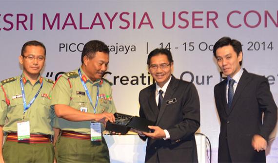
JUPEM recognised internationally for innovative use of mapping technology JUPEM's Defence Geospatial Division (BGSP) has been selected from more than 400,000 organisations worldwide to win a global Special Achievement in GIS (SAG) Award. Learn more
Tan Tock Seng Hospital improves patient care with smart mapping Doctors and staff at Tan Tock Seng Hospital (TTSH) are turning to smart mapping technology to design and enhance clinical services for different segments of the population. Learn more
News Pertamina EP receives international recognition State-owned oil and natural gas corporation, Pertamina EP, has been selected from among more than 400,000 organisations worldwide to receive a Special Achievement in GIS (SAG) award. Learn more
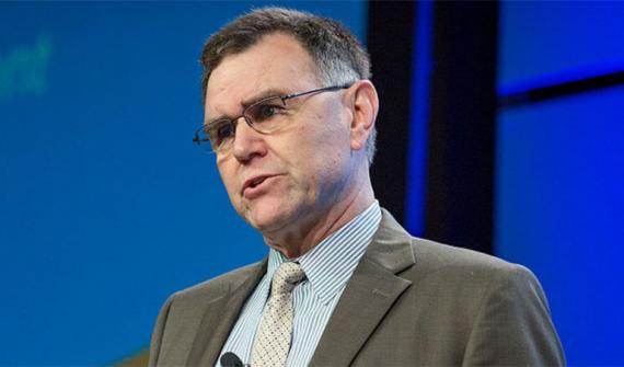
News Advanced geospatial technology to revolutionise national security One of the world's leading geospatial defence experts is in Singapore this week to advise the region's national security stakeholders how state-of-the-art mapping technology can help support mission-critical operations. Learn more
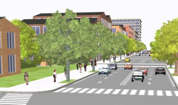
News New technology to future-proof Iskandar Malaysia Iskandar leverages state-of-the-art-technology to transform the region into Malaysia's next economic powerhouse and a strong, sustainable metropolis of international standing. Learn more
News New tech 'geotriggers' Malaysian shopping Personalised instant alerts triggered by virtual boundaries and sent directly to consumers' smartphones are the new weapon being considered by retailers to gain a competitive edge. Learn more
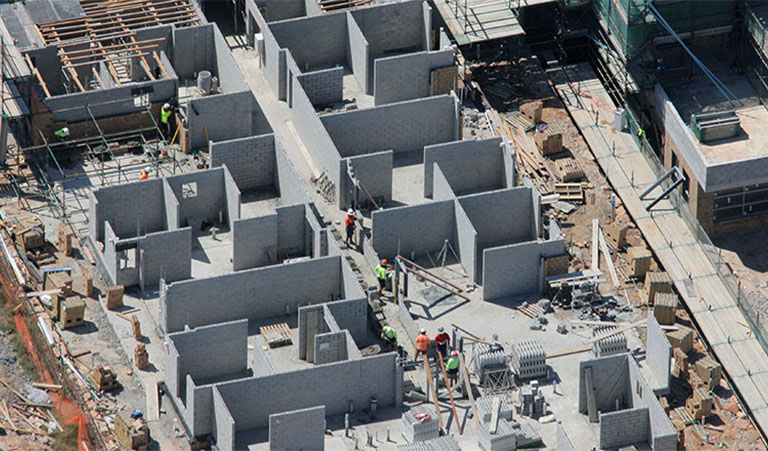
News GIS shapes a brighter future for major electricity utility One of Australia's major electricity providers ensures the reliability and quality of power to a million customers, even in the event of uncontrollable external factors – from bird strikes to bushfires. Learn more